

Emesent Hovermap (STX)
AI-Powered Autonomous LiDAR Mapping System
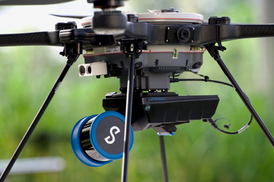
Hovermap is Emesent’s versatile, AI-powered LiDAR mapping system built for GPS-denied and hard-to-access environments. Deployable via drone, ground robot, vehicle, or backpack, Hovermap pairs award-winning SLAM technology with autonomous flight modes to capture survey-grade data in spaces that are otherwise unsafe or unreachable.

Key features
- Long-range, high-density LiDAR — up to 300m sensing range; single-return speeds up to 640,000 points/sec and triple-return up to 1,920,000 points/sec (32-channel), revealing detail through vegetation and canopy.
- Mapping accuracy — ±15mm in general environments, ±10mm indoors/underground, ±5mm isolated change detection.
- Autonomous waypoint mode — beyond-line-of-sight flight with smart waypoint navigation and obstacle avoidance.
- Pilot assist mode — omnidirectional collision avoidance and GPS-denied stability control for close inspection work.
- Mapping mode — fast SLAM-based scanning without drone autonomy, for handheld, backpack, or vehicle capture.
- Plug-and-play versatility — quick-release design switches between drone, handheld, backpack, vehicle, pole, and cage configurations.
- Live point cloud streaming — real-time preview in the Hovermap app during capture.
- Rugged, fleet-friendly build — IP65 weather-sealed, 1.57kg, 512GB storage (~4 hours of sensor data); accessories from the earlier Hovermap ST remain compatible with STX.
Ideal for
Underground mine mapping, autonomous drone inspection, infrastructure and bridge inspection, forestry, emergency response, and terrain mapping across aerial, ground, and handheld workflows.
Works with
Commander (mission planning and control) and Aura (cloud-based processing and visualisation), with export to Autodesk, Trimble, Bentley, and Leica platforms.