Verification is a vital part of construction, ensuring that building works match the specifications and original designs in accordance with the necessary regulations, guidelines, procedures, and best practices.
On-site inspections and assessments are typically required for verification. However, traditional inspections can be time-consuming, prone to human error, and have a lack of transparency. Traditionally, measurements of a physical site would need to be taken manually to compare them with the paper plans.
Failures in verification can lead to delays for projects, changes in the design, and difficulties in completing the construction on schedule and within budget.
To address these issues, reality capture technology offers many advantages for the verification of construction projects.
A more accurate, precise, and transparent method to ensure verification involves comparing the designs in Building Information Modelling (BIM) against spatial data and photographs from the site acquired through laser scanning from mobile mapping technologies. The process enables as-built conditions to be checked alongside the original designs to determine whether the project has been delivered according to specifications.
The benefits of reality capture in construction verification
For construction verification, it is essential to detect any variations between the design and the physical building site as soon as possible. Using advanced scanning devices, reality capture technology combines comprehensive spatial data with 360° photos to provide full site visibility for construction managers and other stakeholders. With the right technology, parties can view and analyse almost every aspect of a construction site without making a physical visit.
Through reality capture technology, operators can access a highly accurate virtual representation of the physical environment to gain an enhanced understanding of the project. Should any variations between the design and physical site be detected, actions can be taken to address them.
Remote teams can also collaborate more effectively through a digital representation. This allows for better communication, problem-solving, and decision-making, even when team members are not physically present.
Site managers can access an accurate representation of the scanned site remotely, monitor operations, identify hazards, and make informed decisions. If any issues are identified remotely, physical visits can be arranged where necessary.
How reality capture solutions enhance verification and QA/QC
Architecture, engineering, and construction professionals (AEC) need complete transparency and reliable information to do their jobs.
Reality capture technology can be used in the verification process by contractors repeatedly taking measurements throughout several construction phases, using the latest spatial data to regularly update the 3D digital representation of the physical site and check it against the BIM model. Furthermore, the model can be overlayed with point cloud data. Using comparison tools such as heat maps or clash detection can confirm if any aspects of the project interfere with others.
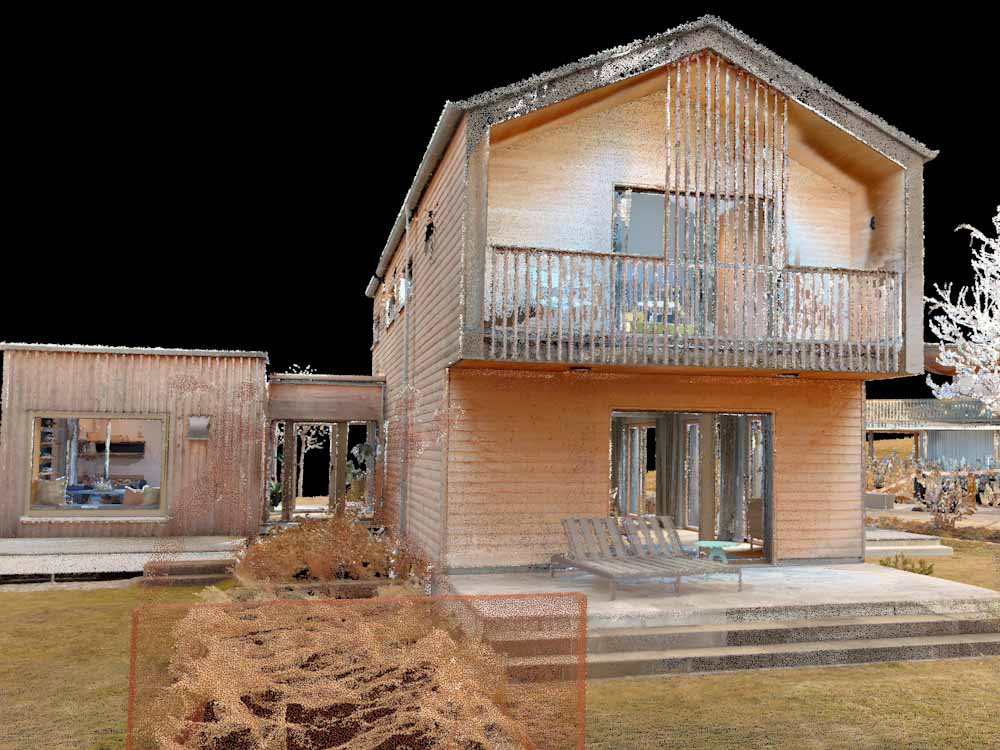
3D scanning technologies can generate an accurate, comprehensive, and detailed point cloud dataset.
Reality capture also facilitates collaboration among different stakeholders involved in the construction process. With a centralised, shared set of spatial data and precise images, architects, engineers, contractors, and facility managers can exchange information seamlessly. This ensures that all parties are aligned with the progress of a project and all necessary regulatory requirements, increasing transparency.
Additionally, reality capture scans can be used for ongoing monitoring and maintenance of buildings to ensure that regulatory standards are met throughout their lifecycle. All of these factors support Quality Assurance (QA) and Quality Control (QC) throughout a construction project and beyond.
Enabling greater precision for construction verification
As a leader in reality capture technologies, NavVis provides advanced solutions for construction verification.
The NavVis reality capture suite combines the NavVis VLX mobile mapping system and NavVis IVION Core online platform. The technologies provide AEC professionals with complete visibility before, during, and after construction.
Precise documentation of the site means errors are either minimised or can be avoided completely. Scanning from NavVis VLX quickly captures complete spatial data and 360° images of a site with precision, regardless of the complexity of the environment. The system is capable of scanning interiors and exteriors to generate point clouds of survey-grade quality.
Both NavVis VLX and IVION can be used by construction contractors, architects, and engineers. All stakeholders can access the same set of scanned data and images of construction sites through the NavVis IVION. The web-based platform is accessible via a standard web browser. Architects can also monitor progress to make sure that works are taking shape according to their plans.
The NavVis reality capture solution provides AEC professionals with cutting-edge construction site documentation tools, allowing them to quickly compare the physical state of the building with the plans to ensure that the project is delivered as intended.
For more information on the uses of NavVis technologies in construction, download the document below.
