
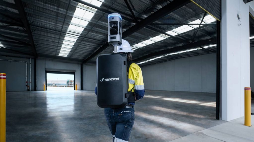
Emesent has unveiled the Emesent GX1, an advanced integrated scanner that combines Simultaneous Localization and Mapping (SLAM) with Real-Time Kinematic (RTK) technology.
The innovation claims to set a new standard in the industry by providing global accuracy of 5-10mm, which significantly enhances precision in topographic surveying and construction projects.
The GX1 can reduce surveying time by up to 95%, transforming weeks of work into a single day of scanning. This all-in-one system integrates LiDAR, RTK, cameras, and software, facilitating a seamless workflow from data capture to deliverable validation.
The technology addresses the challenge faced by survey firms and the Architecture, Engineering, and Construction (AEC) sector, balancing mobile scanning speed with reliable survey-grade accuracy.
The GX1 is designed for various applications, including topographic and road surveys, Scan to Building Information Models (BIM), and construction progress tracking.
It is user-friendly, allowing junior surveyors to be trained and operational within days while meeting the demands of experienced professionals.
The GX1 stands out as the only SLAM-based mobile scanner offering the combination of 5-10mm global accuracy and rapid scanning capabilities.
Its design prioritises client needs, integrating RTK and Emesent’s proprietary SLAM algorithm to ensure consistent results. Emesent's SLAM technology, which also powers the Emesent Hovermap, has been validated in challenging environments, including GPS-denied locations, ensuring repeatable accuracy in both indoor and outdoor settings.
The scanner features four deployment modes: backpack, survey pole, vehicle mount, and handheld, providing flexibility for various surveying scenarios.
Its georeferencing capabilities allow surveyors to gather data in the field with RTK or use Ground Control Points and checkpoints during post-processing, minimising the need for site revisits.
The launch of the GX1 comes at a critical juncture for survey firms and the AEC industry, which are facing a shortage of skilled surveyors.
Concurrently, clients are demanding quicker, cost-effective, and high-quality results, challenging firms to enhance their mobile scanning technologies to maintain a competitive edge.
Key technical specifications of the GX1 include independently validated global accuracy of 5-10mm, integrated RTK georeferencing with real-time quality monitoring, four 20MP cameras for 360° imagery, the proprietary Emesent SLAM algorithm, and the capability for rapid accuracy validation reports via Aura processing software.
Emesent chief strategy officer and co-founder Dr Stefan Hrabar said: “With the introduction of the GX1, we’ve answered the call we’ve heard echoing throughout the surveying industry to end the tug-of-war between fast and accurate. “By putting the power of SLAM into the hands of the everyday surveyor, the GX1 raises the bar for mobile scanning accuracy and keeps critical projects on track.”